readwfs
Read vector features from OGC Web Feature Services (WFS), OGC API Features (OAPIF), and ArcGIS REST endpoints. Returns tibbles with wk geometry columns.
Built on gdalraster.
Installation
# install.packages("pak")
pak::pak("mdsumner/readwfs")
Quick start
library(readwfs)

# What services do we know about?
wfs_services()
#> # A tibble: 2 × 7
#>   name                   url               driver region description srs   notes
#>   <chr>                  <chr>             <chr>  <chr>  <chr>       <chr> <chr>
#> 1 LIST Tasmania          https://services… WFS    Tasma… Cadastral … EPSG… Rich…
#> 2 Esri SampleWorldCities https://samplese… WFS    Global Continents… EPSG… Alwa…

# Tasmania LIST open data WFS
url <- wfs_example_url("list_tasmania")

# What layers are there?
wfs_layers(url, version = "2.0.0", srs = "EPSG:28355")
#>  [1] "Public_OpenDataWFS:Climate_Futures_Tasmania_-_Scenario_A2"
#>  [2] "Public_OpenDataWFS:Climate_Futures_Tasmania_-_Scenario_B1"
#>  [3] "Public_OpenDataWFS:Interim_Planning_Scheme_-_Overlays"
#>  [4] "Public_OpenDataWFS:Interim_Planning_Scheme_-_Zoning_Boundaries"
#>  [5] "Public_OpenDataWFS:Interim_Planning_Scheme_-__Zoning"
#>  [6] "Public_OpenDataWFS:LIDAR_Climate_Futures_Index"
#>  [7] "Public_OpenDataWFS:LiDAR_Coal_Mines_Port_Arthur_Index"
#>  [8] "Public_OpenDataWFS:LiDAR_DPAC_Coastal_Index"
#>  [9] "Public_OpenDataWFS:LiDAR_Mt._Wellington_Index"
#> [10] "Public_OpenDataWFS:LIST_Address_Points"
#> [11] "Public_OpenDataWFS:LIST_Authority_Land"
#> [12] "Public_OpenDataWFS:LIST_Boundary_Segments"
#> [13] "Public_OpenDataWFS:LIST_Building_Points"
#> [14] "Public_OpenDataWFS:LIST_Building_Polygons_2D"
#> [15] "Public_OpenDataWFS:LIST_Cadastral_Parcels"
#> [16] "Public_OpenDataWFS:LIST_Coastline__MHWM_"
#> [17] "Public_OpenDataWFS:LIST_Contours_10m"
#> [18] "Public_OpenDataWFS:LIST_Contours_5m"
#> [19] "Public_OpenDataWFS:LIST_Crown_Leases"
#> [20] "Public_OpenDataWFS:LIST_Crown_Licences"
#> [21] "Public_OpenDataWFS:LIST_Easements__not_a_maintained_dataset_"
#> [22] "Public_OpenDataWFS:LIST_Electoral_Divisions"
#> [23] "Public_OpenDataWFS:LIST_Hydrographic_Areas"
#> [24] "Public_OpenDataWFS:LIST_Hydrographic_Lines"
#> [25] "Public_OpenDataWFS:LIST_Hydrographic_Points"
#> [26] "Public_OpenDataWFS:LIST_Land_Districts"
#> [27] "Public_OpenDataWFS:LIST_Land_Tenure"
#> [28] "Public_OpenDataWFS:LIST_Legislative_Council_Divisions"
#> [29] "Public_OpenDataWFS:LIST_Local_Government_Areas"
#> [30] "Public_OpenDataWFS:LIST_Local_Government_Reserves"
#> [31] "Public_OpenDataWFS:LIST_Locality_and_Postcode_Areas"
#> [32] "Public_OpenDataWFS:LIST_Marine_Leases"
#> [33] "Public_OpenDataWFS:LIST_Marine_Nature_Reserves"
#> [34] "Public_OpenDataWFS:LIST_Named_Feature_Extents"
#> [35] "Public_OpenDataWFS:LIST_Nomenclature"
#> [36] "Public_OpenDataWFS:LIST_Parish_and_Town_Boundaries"
#> [37] "Public_OpenDataWFS:LIST_Points_of_Interest"
#> [38] "Public_OpenDataWFS:LIST_Private_Reserves"
#> [39] "Public_OpenDataWFS:LIST_Public_Land_Classification"
#> [40] "Public_OpenDataWFS:LIST_Ramsar_Wetlands"
#> [41] "Public_OpenDataWFS:LIST_Survey_Control"
#> [42] "Public_OpenDataWFS:LIST_Transport_Nodes"
#> [43] "Public_OpenDataWFS:LIST_Transport_Segments"
#> [44] "Public_OpenDataWFS:LIST_Water_Districts"
#> [45] "Public_OpenDataWFS:LIST_Water_Management_Areas"
#> [46] "Public_OpenDataWFS:Land_Tasmania_Aerial_Photography_Centres"
#> [47] "Public_OpenDataWFS:Land_Tasmania_Aerial_Photography_Coverages"
#> [48] "Public_OpenDataWFS:TASMAP_1_to_100000_Map_Index"
#> [49] "Public_OpenDataWFS:TASMAP_1_to_25000_Map_Index"
#> [50] "Public_OpenDataWFS:TASMAP_1_to_250000_Map_Index"
#> [51] "Public_OpenDataWFS:TASMAP_1_to_5000_Orthophoto_Index"
#> [52] "Public_OpenDataWFS:TASMAP_1_to_50000_Map_Index"
#> [53] "Public_OpenDataWFS:TASMAP_Towns_Street_Atlas_Page_Index__v8_"
#> [54] "Public_OpenDataWFS:LIST_Water_Management_Plan_Areas"
#> [55] "Public_OpenDataWFS:TASVEG_3.0"
#> [56] "Public_OpenDataWFS:TASVEG_4.0"

# Find specific layers
wfs_find_layers(url, "CADASTRAL|TASVEG")
#> [1] "Public_OpenDataWFS:LIST_Cadastral_Parcels"
#> [2] "Public_OpenDataWFS:TASVEG_3.0"
#> [3] "Public_OpenDataWFS:TASVEG_4.0"

# Inspect before downloading
wfs_fields(url, "Public_OpenDataWFS:LIST_CADASTRAL_PARCELS",
           version = "2.0.0", srs = "EPSG:28355")
#> # A tibble: 16 × 7
#>    name       type       subtype   width precision is_nullable is_unique
#>    <chr>      <chr>      <chr>     <int>     <int> <lgl>       <lgl>
#>  1 gml_id     OFTString  OFSTNone      0         0 FALSE       FALSE
#>  2 OBJECTID   OFTInteger OFSTNone      0         0 TRUE        FALSE
#>  3 CID        OFTInteger OFSTNone      0         0 TRUE        FALSE
#>  4 VOLUME     OFTString  OFSTNone      8         0 TRUE        FALSE
#>  5 FOLIO      OFTInteger OFSTInt16     0         0 TRUE        FALSE
#>  6 PID        OFTInteger OFSTNone      0         0 TRUE        FALSE
#>  7 POT_PID    OFTInteger OFSTNone      0         0 TRUE        FALSE
#>  8 LPI        OFTString  OFSTNone      7         0 TRUE        FALSE
#>  9 CAD_TYPE1  OFTString  OFSTNone     60         0 TRUE        FALSE
#> 10 CAD_TYPE2  OFTString  OFSTNone     60         0 TRUE        FALSE
#> 11 TENURE_TY  OFTString  OFSTNone     60         0 TRUE        FALSE
#> 12 FEAT_NAME  OFTString  OFSTNone     60         0 TRUE        FALSE
#> 13 STRATA_LEV OFTString  OFSTNone     60         0 TRUE        FALSE
#> 14 COMP_AREA  OFTReal    OFSTNone      0         0 TRUE        FALSE
#> 15 MEAS_AREA  OFTReal    OFSTNone      0         0 TRUE        FALSE
#> 16 UFI        OFTString  OFSTNone     12         0 TRUE        FALSE

# Read features
parcels <- wfs_read(
  url,
  layer = "Public_OpenDataWFS:LIST_CADASTRAL_PARCELS",
  bbox = wfs_example_bbox("sandy_bay"),
  srs = "EPSG:28355", max_features = 1400
)
#> Reading 'Public_OpenDataWFS:LIST_CADASTRAL_PARCELS': 464 features available, geometry column 'SHAPE'
#>   498 features returned


parcels
#> # A tibble: 498 × 18
#>        FID gml_id  OBJECTID     CID VOLUME FOLIO     PID POT_PID LPI   CAD_TYPE1
#>    <int64> <chr>      <int>   <int> <chr>  <int>   <int>   <int> <chr> <chr>
#>  1    2688 LIST_C…     2688 1104474 59944      4 5677504       0 GRF64 Private …
#>  2    2877 LIST_C…     2877 1023836 128641     1 1816976       0 FMR21 Private …
#>  3    3425 LIST_C…     3425 1145853 126957     1 3273346       0 FJA84 Authorit…
#>  4    4682 LIST_C…     4682 1023837 128641     2 1816984       0 FMR21 Private …
#>  5    6102 LIST_C…     6102 1249716 252507     1 7570663       0 FAC83 Private …
#>  6    6287 LIST_C…     6287 1023828 127656     3 1789939       0 FBF18 Private …
#>  7    6395 LIST_C…     6395 1502061 173638     1 9165211       0 GAV70 Private …
#>  8    8685 LIST_C…     8685 1407763 231575     1       0       0 <NA>  Casement
#>  9   10819 LIST_C…    10819 1334013 152956     1 2818818       0 GDH05 Private …
#> 10   11600 LIST_C…    11600 1091759 58505      2 5677731       0 HSF79 Private …
#> # ℹ 488 more rows
#> # ℹ 8 more variables: CAD_TYPE2 <chr>, TENURE_TY <chr>, FEAT_NAME <chr>,
#> #   STRATA_LEV <chr>, COMP_AREA <dbl>, MEAS_AREA <dbl>, UFI <chr>,
#> #   geometry <wk_wkb>
wk::wk_plot(parcels$geometry)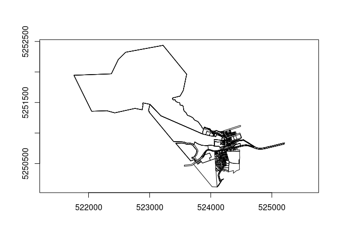
Service type auto-detection
readwfs detects the service type from the URL pattern:
| URL pattern | GDAL driver | Example |
|---|---|---|
WFSServer, service=WFS
|
WFS | Tasmania LIST, Esri SampleWorldCities |
arcgis/rest/…/MapServer, FeatureServer
|
ESRIJSON | ArcGIS REST services |
/collections, ogc/features
|
OAPIF | OGC API Features |
Or set driver explicitly: wfs_read(url, layer, driver = "ESRIJSON").
Exported functions
| Function | Purpose |
|---|---|
wfs_services() |
Catalogue of known public endpoints |
wfs_layers() |
List all layers on a service |
wfs_find_layers() |
Search layers by regex pattern |
wfs_layer_info() |
Geometry type, extent, feature count |
wfs_fields() |
Attribute schema for a layer |
wfs_read() |
Fetch features → tibble + wk geometry |
wfs_example_url() |
Pre-configured example URLs |
wfs_example_bbox() |
Pre-configured bounding boxes |
Design
- gdalraster for all I/O — no sf or terra required
- wk vectors for geometry interchange
- tibble for tabular output (unclassed, no sticky geometry)
- geos for spatial operations (suggested, not required)
Contributing example services
If you find a good public WFS / OAPIF / ArcGIS REST endpoint, open an issue. Good candidates are: no authentication required, reasonably fast, interesting data, and ideally from a different part of the world than existing examples.
Code of Conduct
Please note that the readwfs project is released with a Contributor Code of Conduct. By contributing to this project, you agree to abide by its terms.